
Contents:
How to use the Cycle journey Planner
Click on the map to choose a point where you would like to start or finish your journey. You might want to zoom the map (using the slider or [+] and [-] buttons on the left) or drag it around to choose this point more precisely.
You can also start typing into the text box and the journey planner will start looking for matching places. It prefers places that are located near to the centre of the map. You can help it by typing the street name and place name separated by a comma. E.g. Oxford Road, Goodshire. The search can also find some other places e.g. the bike shop Best Cycles, Goodshire. Full postcode search is also available.
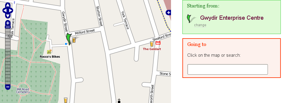
A grey marker appears briefly at the location where the mouse was clicked. After a few moments the grey marker disappears and a green marker appears at the nearest point on the street network.
When the Start and Finish points are set you can optionally set a departure or arrival time. It tries to make sense of what is entered here (e.g. 10:30), but if it cannot make sense of it the current time is assumed. There is also an option for setting your precise cycling speed.
When you're happy with the suggested start and finish points and departure time, choose the big "Plan my route button". You will be taken to a new page containing your journey number and after a few seconds your suggested routes will begin to appear.
The quality of the route presented depends on how much knowledge the journey planner has about your area. If you don't get a satisfactory route, or if route planning wants to start a long way from where you clicked that is because the journey planner hasn't got sufficient detail (or there genuinely isn't a good route). Please use the links provided to give feedback if the route is odd. We continue to receive feedback and this helps us to improve the system.
Types of route
The journey planner uses the network and details of the different types of cycling provision to suggest cycling routes. The following route types are available. Each type may include some sections where you have to dismount and walk with your cycle. For these the walking speed is assumed to be 6km/h.
- Fastest
- Displays the fastest route according to the expected average speed on each type of link. (It assumes you can cycle at those speeds.) Some routes include a time penalty, e.g. where there are traffic lights, Toucan Crossings, or even crossing roads. These routes may rarely include a section where you have to walk your cycle because it is faster than cycling there another way.
- Balanced
- A balance between the fastest and quietest; this is the default planning mode.
- Quietest
- Some cyclists prefer quiet routes, away from busy traffic. They are prepared to travel further along back streets, and paths across a park to avoid more direct routes along busier roads.
What other sites have cycle maps?
How do I fly in Google Earth?
You need the Google Earth software. When a Journey has been successfully calculated you are provided with a link to "Fly in Google Earth". Use your menu click button (usually the right mouse button) to Save the contents of that link to a file such as cyclestreets500quietest.kml. Then open this file directly or from Google Earth. It will display the region of the route overlaid on a map of the Earth. Find the button to play the route: it is usually visible at the bottom right of the middle panel on the left handside of the Google Earth program. Alternatively try choosing: Tools > Play Tour. If you did it correctly it should take you along the route as an animation. The animation speed can be controlled by some of the settings in Google Earth. Choose Tools > Options... > Control then adjust the Tour Settings.
How do I copy to my GPS device?
The file format .gpx is a popular way of sharing information between GPS (Global Positioning System) devices and software. Use the link provided on the journey listing page to save the displayed route for this journey number to a file such as cyclestreets500fastest.gpx. This can then be imported to your GPS device so that you can follow the route.
- The routes inside the exported file will be named according to the pattern <plan> <start> to <finish>, e.g. Fastest Downing Street to Buckingham Palace.
- Only the selected route for the journey is included in the export. [Previously all routes were exported, but we changed this following user feedback.]
- The first point on each street is named.
We are interested to hear feedback on how we can further develop this feature.